LIVING IN OTTAWA
Commuting in Ottawa: A Homebuyer's Guide to Transit and Driving
Last updated: October 2026 · Part of our Living in Ottawa guide
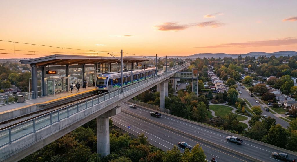
Commuting in Ottawa usually means one of three things: taking OC Transpo’s O-Train and buses, driving Highway 417 or the city’s main arteries, or crossing a bridge to Gatineau. The O-Train’s Line 1 runs east–west through downtown from Blair to Tunney’s Pasture, Line 2 runs north–south from Bayview to Limebank, and Line 4 links the airport to South Keys, with east and west extensions under way.
For homebuyers, the commute often decides between two neighbourhoods. This guide explains how the network works today, what’s changing and how to judge a commute before you buy.
How Ottawa Commutes
Ottawa is spread out. The city covers urban neighbourhoods inside the Greenbelt, large suburbs outside it (Kanata and Stittsville in the west, Barrhaven and Riverside South in the south, Orléans in the east) and rural villages such as Manotick, Carp and Greely. Most suburban commuters drive or combine buses with the O-Train, while many central residents walk, cycle or take a single transit trip.
With most federal public servants now required on site four days a week, as Global News reported in February 2026, commute time matters more to Ottawa buyers than it did a few years ago.
Commuting Is Back
Ottawa’s return to the office shows up in the data. In May 2025, 76.0% of workers in Ottawa–Gatineau were commuters, working most of their hours outside the home, up 9.5 percentage points from a year earlier, the largest increase among Canada’s 15 largest metropolitan areas, according to Statistics Canada. Nationally, the average commute was 26.7 minutes, and 80.9% of commuters travelled by car, truck or van, compared with 11.9% by public transit.
The O-Train Today
According to the O-Train’s Wikipedia overview, three lines operate as of 2026.
Line 1 (Confederation Line)
Line 1 is the electric light-rail line running east–west from Blair to Tunney’s Pasture through downtown, with 13 stations. It opened on September 14, 2019. It’s the backbone for downtown commuters, with major transfer points to buses at its ends.
Line 2 (Trillium Line)
Line 2 is a diesel light-rail line running north–south from Bayview to Limebank in Riverside South. It reopened on January 6, 2025, after an extended closure for upgrades and extension. It connects to Line 1 at Bayview and serves Carleton University, Mooney’s Bay and the southern suburbs.
Line 4 (Airport Line)
Line 4 opened on January 6, 2025, and links the Ottawa airport to South Keys, where it connects with Line 2.
Commuting from outside the city? See our guide to the Almonte to Ottawa commute, which covers County Road 49, Highway 7 and winter driving.
The O-Train Extensions: What’s Coming
Two major Stage 2 extensions will change commuting for the east and west ends:
- East extension: Line 1 is being extended to Trim Road in Orléans. Substantial completion was reached in March 2026, but testing had not started, and there was no current opening timeline as of the latest update.
- West extension: Line 1 is being extended west to Algonquin, and a new Line 3 will run to Moodie Drive, near the Department of National Defence’s Carling Campus. The City’s west extension highlight sheet describes 15 km of new rail and 11 stations: Westboro, Dominion, Cleary, New Orchard, Lincoln Fields, Iris, Baseline, Queensview, Pinecrest, Bayshore and Moodie, connecting to the West Transitway toward Kanata and the Southwest Transitway toward Barrhaven. The sheet originally planned service for 2025, and opening is now expected in the third quarter of 2027.
Transit projects in Ottawa have a history of delays, so buy based on the service that exists today and treat future service as a bonus. Our guide to living near the O-Train covers what station proximity means for a home, and our Westboro guide to the O-Train west extension looks at one corridor in detail.
Sell Your Ottawa Home for Just 1% Listing Commission
Why pay 2.5% listing commission to sell your home when you don't have to? Jason Polonski lists Ottawa homes for a simple 1% listing commission. Full MLS® and REALTOR.ca exposure, professional photography, powerful online marketing, expert pricing, and a skilled negotiator fighting for every dollar of your sale price. Top-tier service — you just keep thousands more when your home sells. Smart sellers are already making the switch. Your home deserves the best, and your wallet deserves a break.
Driving: Highway 417, 416 and the Main Arteries
Highway 417 (the Queensway) runs east–west across the city, connecting Kanata and Stittsville to downtown and Orléans. Highway 416 runs south from the 417 toward Barrhaven’s western edge and on to the 401. North–south arteries such as Woodroffe, Greenbank, Merivale, Riverside Drive and Hunt Club Road carry much of the suburban traffic.
Driving times change enormously between midday and rush hour, and between summer and a January snowstorm. A route that takes 20 minutes on a Sunday can take far longer at 8 a.m. on a weekday.
Get Cash Back When You Buy a Home in Ottawa
Can you get cash back when buying a home in Ottawa? Yes. Jason Polonski, a Chairman's Club REALTOR® serving Ottawa and Kanata, shares part of his commission with buyers — up to $3,000 cash back at closing.* You still get full-service, award-winning representation: expert pricing, sharp negotiation, and hands-on guidance from first showing to keys in hand. No cut corners and no rebate-only shortcuts — just real money back in your pocket when you buy your Ottawa or Kanata home.
Commuting to Gatineau
Thousands of Ottawa residents work in the federal complexes across the river in Gatineau, including Place du Portage, the largest office complex in the National Capital Region. The bridges are the bottleneck at rush hour.
Gatineau’s transit agency, the STO, runs buses into downtown Ottawa and the Rapibus busway within Gatineau, though Rapibus itself doesn’t cross the river. If your office is on the Quebec side, compare both cities as places to live. See Ottawa vs Gatineau.
The Five Interprovincial Bridges
Drivers cross between Ottawa and Gatineau on five federal bridges, listed by Public Services and Procurement Canada:
- Champlain Bridge, the westernmost, linking the Island Park and Westboro area to Gatineau’s Aylmer sector
- Chaudière Crossing, near LeBreton Flats
- Portage Bridge, near the Parliamentary Precinct and Place du Portage
- Alexandra Bridge, between the ByWard Market area and Hull, which has had a 27-tonne load restriction on all vehicles since March 2020
- Macdonald-Cartier Bridge, the eastern crossing, linked to Highway 5 on the Quebec side
Lane reductions and closures are common, especially in summer and fall. Check the federal closures page before you rely on one route, and test the bridge at rush hour if you’ll cross daily.
Where the Jobs Are
Ottawa’s major employment areas include:
- Downtown and the Parliamentary Precinct
- Tunney’s Pasture, home to Statistics Canada and Health Canada, at the western end of Line 1
- The NDHQ Carling Campus at Moodie Drive, where DND plans to consolidate about 8,500 personnel
- Kanata North, the city’s main technology park
- Confederation Heights, with Canada Revenue Agency and Canada Post facilities
- Hospitals, including the General, Civic and Queensway Carleton campuses
- Gatineau’s federal complexes
Our guide to moving to Ottawa for a government job maps federal workplaces to the neighbourhoods that commute well to each.
Choosing a Home for the Commute
Before you buy, test the commute the way you’d actually do it:
- Drive or ride it at rush hour, not on a weekend.
- Check the walk to the stop or station. A home 1.5 km from a station is a different commute from one 400 metres away, especially in winter.
- Look at frequency. A route that runs every 30 minutes is much less flexible than one that runs every 5 to 10.
- Consider park and ride. Many suburban commuters drive to a station or transitway stop and ride in. OC Transpo lists lots, maps and permits on its Park & Ride page. Check parking availability at the times you’d arrive.
- Price the trip. As of January 1, 2026, an adult Presto fare is $4.10 and an adult monthly pass is $138.50, according to OC Transpo’s fare table. Ask your employer whether it offers a transit pass program.
- Plan for winter. Snow adds time to every trip, and long walks to a stop feel longer in January.
- Think about resale. Good transit access tends to broaden a home’s appeal to future buyers, including those without a car.
Our guide to the best areas to live in Ottawa without a car compares the most transit-friendly neighbourhoods.
Neighbourhood Commuting Guides
- Public transit in Kanata
- Public transit options in Stittsville
- Commuting from Nepean
- Commuting from Manotick
- Commuting from Carp
- Commuting from Dunrobin
- Commuting from Constance Bay
- Living near the O-Train west extension (Westboro)
Want to Test a Commute Before You Buy?
Jason can show you how a home connects to your workplace by car and transit, and which nearby neighbourhoods offer a shorter trip for a similar price. Call or text (613) 601-9333.
Related Living in Ottawa Guides


Posted on Google 

Jennifer Clark
3 days ago
 Trustindex verifies that the original source of the review is Google.
His availability to communicate was incredible which is so important when selling a house. Great at everything else too.
Posted on Google

Aarushi Govil
14 days ago
Trustindex verifies that the original source of the review is Google. Working with Jason has been an absolute privilege from start to finish. Finding the right realtor can be daunting, but Jason exceeded every expectation. He is remarkably knowledgeable and was extremely punctual and responsive to every question or request we had, no matter the time or the day. What stood out most was his complete sincerity and zero-pressure approach. When we walked through houses, he was transparent, pointing out both the pros and potential red flags instead of trying to make a quick sale. His honest feedback gave us complete confidence in our decision. If you want a dedicated, honest, and highly skilled agent in your corner, look no further than Jason!
Posted on Google

Joe Ireland
28 days ago
Trustindex verifies that the original source of the review is Google. Jason helped me buy my first home.
He was extremely responsive and available from our very first call, and assisted with booking multiple viewings across Ottawa.
He was punctual to every viewing and honest with his feedback with the homes we saw, and when it came time to go from viewing to buying, he had an impressive array of contacts from brokers to inspectors to lawyers, all with excellent reviews and who were great to work with in their own right.
As a first-time home buyer, his responsiveness and patience with many questions were extremely reassuring and really streamlined the process, and I signed an offer on my home within just 2 weeks of meeting him.
I would strongly recommend Jason to anyone buying a home in Ottawa, especially to those who are strangers to the process like I was.
Thank you again, Jason!
Posted on Google

Marina
58 days ago
Trustindex verifies that the original source of the review is Google. We had a wonderful experience working with our realtor - Jason Polonski. He is a professional, knowledgeable, responsive, and truly attentive to our needs. Jason guided us through every step of the process, answered all of our questions. My family are very grateful for his work and would absolutely recommend him to anyone looking for a reliable and trustworthy realtor in Ottawa and around !
Posted on Google

Vatrul “Vatrul”
62 days ago
Trustindex verifies that the original source of the review is Google. First time home seller. Every process of the journey was explained and laid out perfectly.. Very highly recommended.. thank you Jason..
Posted on Google

Olga V.
63 days ago
Trustindex verifies that the original source of the review is Google. Jason is very knowledgeable realtor in Kanata. He’s been always good beyond to help his clients. We had a place experience buying a house in Kanata. I highly recommend him.
Posted on Google

Yuri Tsouker
70 days ago
Trustindex verifies that the original source of the review is Google. Working with Jason on the sale of my property was genuinely one of the smoothest professional experiences I've had. He was responsive at every step, patient with every question (and I had many), and he clearly knew the local market inside and out.
My sale wasn't a simple one — there was a tenant, a rental water heater, a plumber to coordinate, and plenty of complications that made this a genuinely difficult case. Jason handled all of it with calm, practical advice and always got back to me quickly, often with a solution before I even finished asking about the problem.
What stood out most was his honesty. He didn't push, he didn't overpromise, and every recommendation he made turned out to be exactly right. I felt like I had a professional in my corner from day one.
If you're looking for a realtor who is knowledgeable, responsive, and genuinely trustworthy, I can't recommend Jason highly enough. Thank you, Jason — much appreciated!
Posted on Google

Denis Pepin
94 days ago
Trustindex verifies that the original source of the review is Google. Outstanding Experience with Jason Polonski!
Last May, my wife and I sold our home in Stittsville with Jason Polonski, and we couldn't be happier with our decision. Jason made the entire process remarkably smooth and stress-free.
From day one, Jason stood out for his exceptional communication. He was always prompt and available to answer our queries—often within minutes—no matter the time of day. Whenever we had questions regarding paperwork, listing strategies, or handling property details, he addressed every concern with a truly genuine, human touch.
What impressed us most was how proactive and reassuring he was at every step. When we had to coordinate the buyout of our water heater rental, Jason handled the reimbursement seamlessly, reassuring us with, "We should have a smooth sale now. :)"—and it truly was! Even post-closing, when we needed to arrange delivery for mailbox keys or track down final funds from head office, Jason stayed on top of every detail, putting a rush on things and constantly keeping us updated.
Jason is a dedicated, attentive, and highly professional realtor who genuinely cares about his clients. It has been an absolute pleasure working with him, and we highly recommend Jason Polonski to anyone looking to buy or sell a home in the Ottawa region.
Posted on Google

Tammy Puhakka
103 days ago
Trustindex verifies that the original source of the review is Google. I highly recommend Jason Polonski, a realtor in Kanata, Ottawa. He truly went above and beyond for me. During a long weekend, he called me and, within just two hours, had an offer to purchase prepared and sent so I could secure the home I had found and fallen in love with.
Jason was professional, efficient, knowledgeable, and incredibly pleasant to work with. His rates are very reasonable, and his dedication to his clients is outstanding. If you’re looking for fast, reliable, and friendly service, I would absolutely recommend contacting him.❤️
Posted on Google

Joe Melindy
108 days ago
Trustindex verifies that the original source of the review is Google. Everything went smoothly. Jason is very good at what he does. Would highly recommend. Thanks Jason 😊
Working With Jason Polonski
Jason Polonski is a Kanata-based REALTOR® with Right at Home Realty and more than 15 years of experience helping buyers across Ottawa. He knows how the west end’s commute works from daily experience and helps buyers weigh a longer drive against more space or a lower price.
His background in construction and the electrical trades helps him assess a home’s condition, and his Bachelor of Commerce from Concordia University, with a double major in Marketing and Finance, helps buyers weigh commute, price and resale together. Read his Google reviews or learn more about Jason.
Frequently Asked Questions About Commuting in Ottawa
Line 1 runs east–west from Blair to Tunney’s Pasture, Line 2 runs north–south from Bayview to Limebank, and Line 4 runs from the airport to South Keys.
The east extension to Trim Road reached substantial completion in March 2026 but had no confirmed opening date. The west extension, including a new Line 3 to Moodie Drive, is expected in the third quarter of 2027. It ends near Bayshore and the Carling Campus rather than in Kanata itself.
It depends on where you live and work. Downtown and Tunney’s Pasture commuters often do well on transit, while many suburban commuters to Kanata North or the Carling Campus drive.
Do the trip at rush hour on a weekday, by car and by transit, and check the walk to the nearest frequent route or station.
Transit access can widen a home’s appeal to buyers, but price depends on many factors. Compare recent sales near stations with similar homes farther away.
By car across the interprovincial bridges or by STO and OC Transpo buses. Rush-hour bridge traffic is the main bottleneck.
Five interprovincial road bridges: the Champlain Bridge, Chaudière Crossing, Portage Bridge, Alexandra Bridge and Macdonald-Cartier Bridge. Public Services and Procurement Canada posts closures and lane reductions.
Yes. In May 2025, 76.0% of Ottawa–Gatineau workers were commuters, up 9.5 percentage points in a year, the largest jump among Canada’s 15 largest metropolitan areas, according to Statistics Canada.
